")
Premier 3D Aerial View Rendering Service Chicago
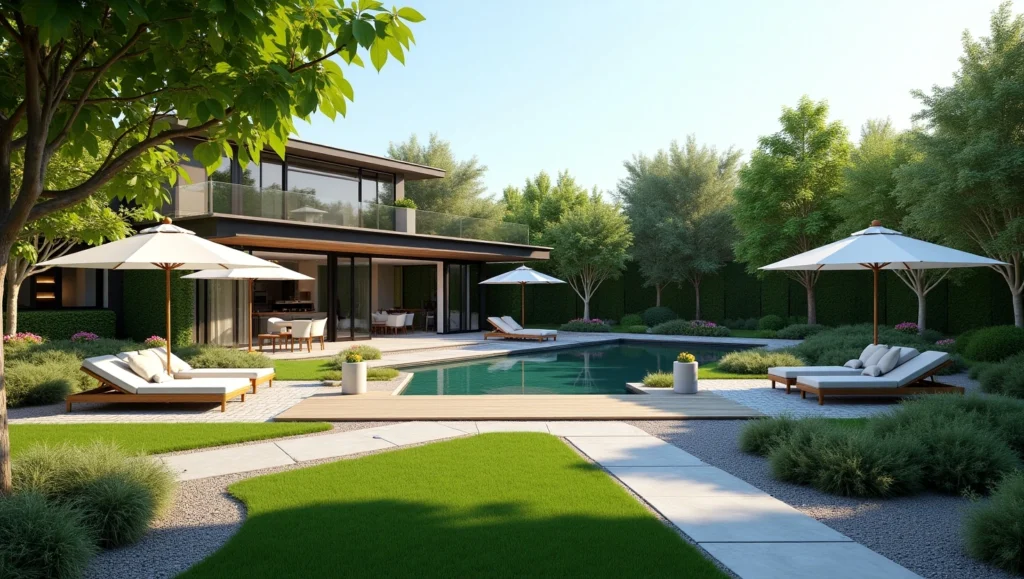
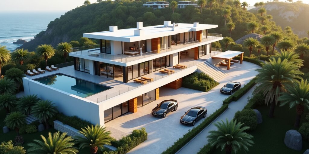
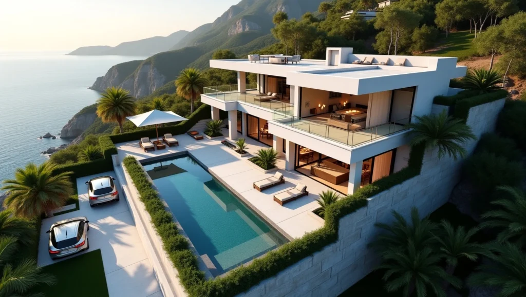
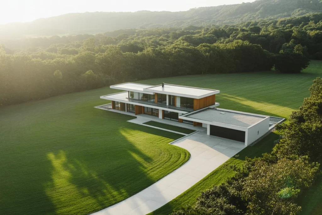
RenderLand is Chicago’s trusted 3D aerial view rendering Chicago studio, delivering cinematic, photorealistic aerial visualization that turns complex development data into compelling visual stories. From downtown high-rises to suburban masterplans, we transform GIS, CAD, and BIM inputs into photorealistic aerial visualization Chicago that wins zoning approvals, secures funding, and accelerates pre-sales. As a Chicago aerial rendering company, we’ve helped over 120 projects across Cook County and beyond reach entitlement and market success since 2015. Whether you’re presenting to the Plan Commission, pitching institutional investors, or launching a sales gallery, our Chicago-based 3D aerial visualization studio delivers aerial CGI visualization for property marketing that moves the needle. Request a quote or view our aerial view portfolio today!
What Is 3D Aerial Rendering—and Why It’s Critical for Chicago Developers
3D aerial rendering is the art and science of creating bird’s-eye architectural rendering Chicago using advanced 3D modeling, texturing, and rendering engines like V-Ray and Unreal Engine. Unlike drone photography limited by weather, FAA regulations, and fixed perspectives, 3D aerial perspective rendering for real estate developers gives you complete creative control. You choose the altitude (50 ft to 5,000 ft), time of day, season, and even future build-out phases.
For Chicago’s development community, this capability is no longer a luxury, it’s a necessity. The city’s dense urban fabric, complex zoning overlays, and competitive capital markets demand visuals that instantly communicate scale, context, and vision. Traditional 2D site plans and ground-level renderings leave too much to interpretation. Investors want to see how a 40-story tower integrates with the skyline. Planners need to evaluate shadow impacts on adjacent parks. Marketing teams require hero images that sell lifestyle before the foundation is poured.
Our virtual aerial rendering for property development proposals solves these challenges by delivering:
Clarity
Every parcel line, setback, and street grid is geometrically accurate.
Context
Surrounding buildings, transit lines, and landmarks are modeled from real GIS data.
Impact
Cinematic lighting and atmospheric effects create emotional resonance.
Flexibility
Revise massing, materials, or phasing without reshooting.
In a market where rendering for land-use and zoning presentations can make or break a project, aerial CGI for residential and commercial developers has become the gold standard. Aerial views are produced as part of our integrated architectural visualization services in Chicago.
Core Applications That Drive Real-World Outcomes
We tailor every aerial visualization to its intended audience and objective. Here are the three primary use cases we serve:
Developers & Urban Planners
Goal:
Secure entitlements and public support.
Deliverables:
- Zoning-compliant massing studies with height plane overlays
- Shadow studies synced to solstice and equinox
- Phased build-out sequences for PD/PDP submissions
- Traffic impact visualizations with animated vehicle flow
Result:
Average 38% reduction in review cycles at Chicago Plan Commission when aerial CGI replaces 2D drawings.
Real Estate Marketing & Sales Teams
Goal:
Generate leads and close pre-sales.
Deliverables:
- Hero stills for sales gallery walls and digital billboards
- 60-second 4K flythroughs for website homepages
- Interactive 3D web viewers with unit selector overlays
- Social media–optimized vertical video clips
Result:
Projects using aerial CGI for real estate marketing agencies see 2.8x higher website dwell time and 31% more qualified leads.
Architects & Design Teams
Goal:
Communicate design intent at scale.
Deliverables:
- Context-integrated design options (3–5 massing variants)
- Material studies from 1,000 ft altitude
- Cutaway diagrams revealing interior public spaces
- VR-enabled aerial walkthroughs for client charrettes
Result:
Site plan and masterplan 3D visualization reduces design revision meetings by 45%.
In a market where rendering for land-use and zoning presentations can make or break a project, aerial CGI for residential and commercial developers has become the gold standard.
Photorealism: Where Technical Precision Meets Visual Storytelling
Great aerial rendering isn’t just about accuracy, it’s about emotional impact. We achieve this through obsessive attention to environmental detail:
| Element | How We Model It | Chicago-Specific Accuracy |
|---|---|---|
| Terrain | LiDAR-derived DEMs with 1 ft contour intervals | Matches USGS and Cook County GIS elevation data |
| Vegetation | SpeedTree libraries with native species (e.g., London plane, burr oak) | Seasonal variants: spring bloom, autumn color, winter bare |
| Water Bodies | Fluid simulation for wave height and reflection | Lake Michigan color calibrated to NOAA buoy data |
| Atmosphere | Volumetric fog, god rays, and aerial perspective | Haze levels based on O’Hare visibility reports |
| Lighting | Physically accurate sun position + HDRI sky domes | Time-stamped to your presentation date (e.g., June 21, 4:30 PM) |
This level of photoreal topography and terrain rendering ensures your project doesn’t float in a generic void, it sits convincingly in Chicago’s real urban landscape. Our environment lighting and shadow realism in aerial views has convinced skeptical community groups that new towers won’t darken beloved parks.
Specialized Aerial Visualization Services
We offer a full spectrum of drone-view 3D rendering Chicago solutions, modular and scalable:
Micro-Site Aerials (≤2 acres)
Perfect for infill condos or boutique office buildings.
Neighborhood-Scale (2–50 acres)
Mixed-use districts and campus expansions.
Masterplan Aerials (50–1,000+ acres)
Ideal for new towns, industrial parks, and airport-adjacent logistics.
Infrastructure Visualization
Highways, rail corridors, and utility easements.
Animated Flythroughs
Scripted camera paths with music and professional voiceover.
Interactive WebGL Viewers
Embeddable, mobile-friendly, and plugin-free experiences.
Every service includes 3D mapping visualization for construction firms with progress tracking overlays, ideal for monthly investor reports. Aerial renderings are often combined with high-detail exterior rendering services for site-wide presentations.
Our Transparent Workflow: From GIS to Final Pixel
We’ve refined a architectural visualization workflow for aerial rendering that integrates seamlessly with your team’s tools:
Data Onboarding (Day 1)
- Accept: GIS shapefiles, CAD DWG/DXF, Revit RVT, Civil 3D, SketchUp, or PDFs
- Validate coordinate systems (Illinois State Plane East NAD83)
- Flag discrepancies (e.g., mismatched parcel lines)
Base Model Assembly (Days 2–3)
- Extrude building footprints to proposed heights
- Sculpt terrain from LiDAR or contour data
- Import infrastructure (Metra, Divvy stations, protected bike lanes)
Contextual Dressing (Days 4–5)
- Add 3D buildings within 1-mile radius (simplified massing)
- Place trees, street furniture, vehicles at real densities
- Texture pavement with Chicago-specific materials (CDOT standard asphalt)
Photoreal Pass (Days 6–8)
- Apply PBR materials with micro-displacement
- Set up HDRI lighting rig with sun position lock
- Render multi-pass EXR files for compositing flexibility
Client Review & Revisions (Days 9–10)
- Share 1080p watermarked previews via Frame.io
- Incorporate feedback (“raise parapet 3 ft,” “add rooftop amenity”)
- Final high-res output: 8K TIFFs, 4K ProRes video, WebGL build
Delivery & Archival (Day 11)
- Secure file transfer + cloud backup
- Provide layered PSDs for your graphic designer
- Archive project for future phasing updates
This GIS and CAD data integration in 3D aerial visualization ensures 100% geometric fidelity, your architect’s Revit model matches our aerial output to the inch.
Marketing Assets That Convert Viewers into Buyers
The best aerial renderings don’t just impress, they sell. We produce:
Print-Ready Hero Images
8K resolution, ICC-profiled for offset printing.
Digital Billboard Stills
16:9 aspect, high contrast for Michigan Avenue displays.
Social Media Carousels
1:1 and 4:5 crops with animated zoom-ins for engagement.
Virtual Flyover Visualization
60-second cinematic sequences with licensed Chicago jazz tracks.
Masterplan CGI & Marketing Visuals
Annotated with unit counts, parking ratios, and retail SF.
This GIS and CAD data integration in 3D aerial visualization ensures 100% geometric fidelity, your architect’s Revit model matches our aerial output to the inch.
Chicago-Focused Expertise: We Know This City from 30,000 Feet
As a 3D rendering studio serving downtown Chicago developers, we bring unmatched local intelligence:
| Zoning Code | Model bonus FAR envelopes, TOD setbacks, and planned development overlays. |
|---|---|
| Landmarks Commission | Render cornice lines and material transitions to satisfy preservation standards. |
| Community Areas | Differentiate architectural character: masonry in Logan Square vs. glass in Fulton Market. |
| Transit Infrastructure | Include future CTA extensions and Divvy expansion zones in long-range aerials. |
| Weather Patterns | Simulate lake-effect snow accumulation and wind-driven rain for resilience studies. |
We’ve rendered projects in 47 of Chicago’s 77 community areas, from property marketing visuals for Chicago and Cook County developments to urban development rendering for Chicago agencies. Our top-down architectural rendering experts in Greater Chicago have earned referrals from the Department of Planning and Development itself.
Portfolio & Case Studies: Proof in Every Pixel
Case Study 1: 1.2M SF Office Tower – River North
Challenge: Convince lender that 45-story addition wouldn’t overwhelm historic district.
Solution: Dawn-to-dusk aerial sequence showing shadow migration.
Result: $180M construction loan closed 30 days after presentation.
Case Study 2: 180-Acre Corporate Campus – Schaumburg
Challenge: Village required proof of pedestrian connectivity across wetlands.
Solution: Animated aerial path tracing walkways and boardwalks.
Result: Unanimous PUD approval; broke ground 60 days later.
Case Study 3: West Loop Mixed-Use Podium
Challenge: Market 400 residential units above active rail corridor.
Solution: Interactive aerial viewer with sound-dampening wall cutaways.
Result: 75% pre-sold before vertical construction began.
View the full 3D rendering portfolio for property development projects, large-scale site rendering and visualization, and real estate project visualization from aerial perspective.


Affordable Pricing
Smart budget-friendly options without cutting corners.

Top-Notch Quality
Superior quality delivered with professional precision.

Timely Project Completion
Reliable delivery backed by efficient planning.

Dedicated Support
Personalized and responsive assistance whenever you need it.

Team Collaboration
Open communication and teamwork at every step.

Advanced Technology
Harnessing modern tools for outstanding results.

Client Satisfaction
We prioritize your goals and exceed expectations every time.

Creative Solutions
Innovative ideas that drive your success forward.

Streamlined Workflow
Efficient processes that save time and reduce hassle.
Ready to See Your Vision from the Sky?
Request a 3D aerial rendering quote Chicago now, upload your CAD or GIS files and receive a detailed scope within 24 hours.
Start your aerial visualization project with zero risk: every quote includes a free low-res concept frame.
Book a Chicago aerial rendering consultation with our lead visualization strategist.